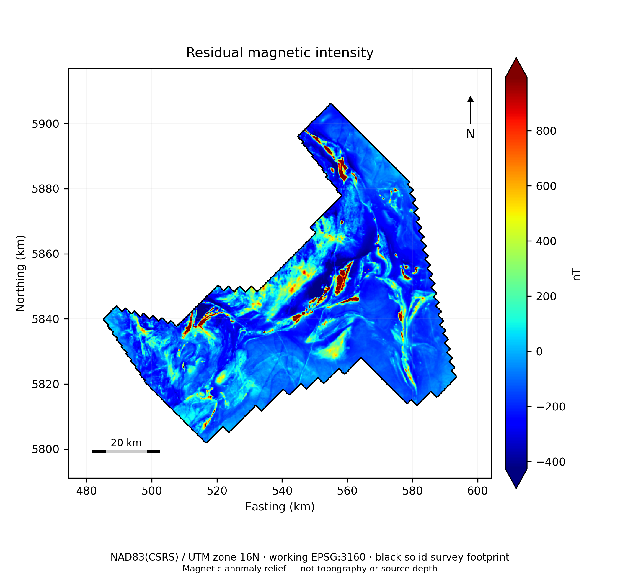
Magnetic intensity, reduced-to-pole response, gradients and other derivatives help identify domains, contacts, lineaments and source-scale features. Agreement among derivatives tests stability, not mineral identity.
Figure 1. Residual magnetic intensity and survey footprint. Source: Ring of Fire interpretation report, reviewer revision, 28 September 2026. Preliminary interpretation.
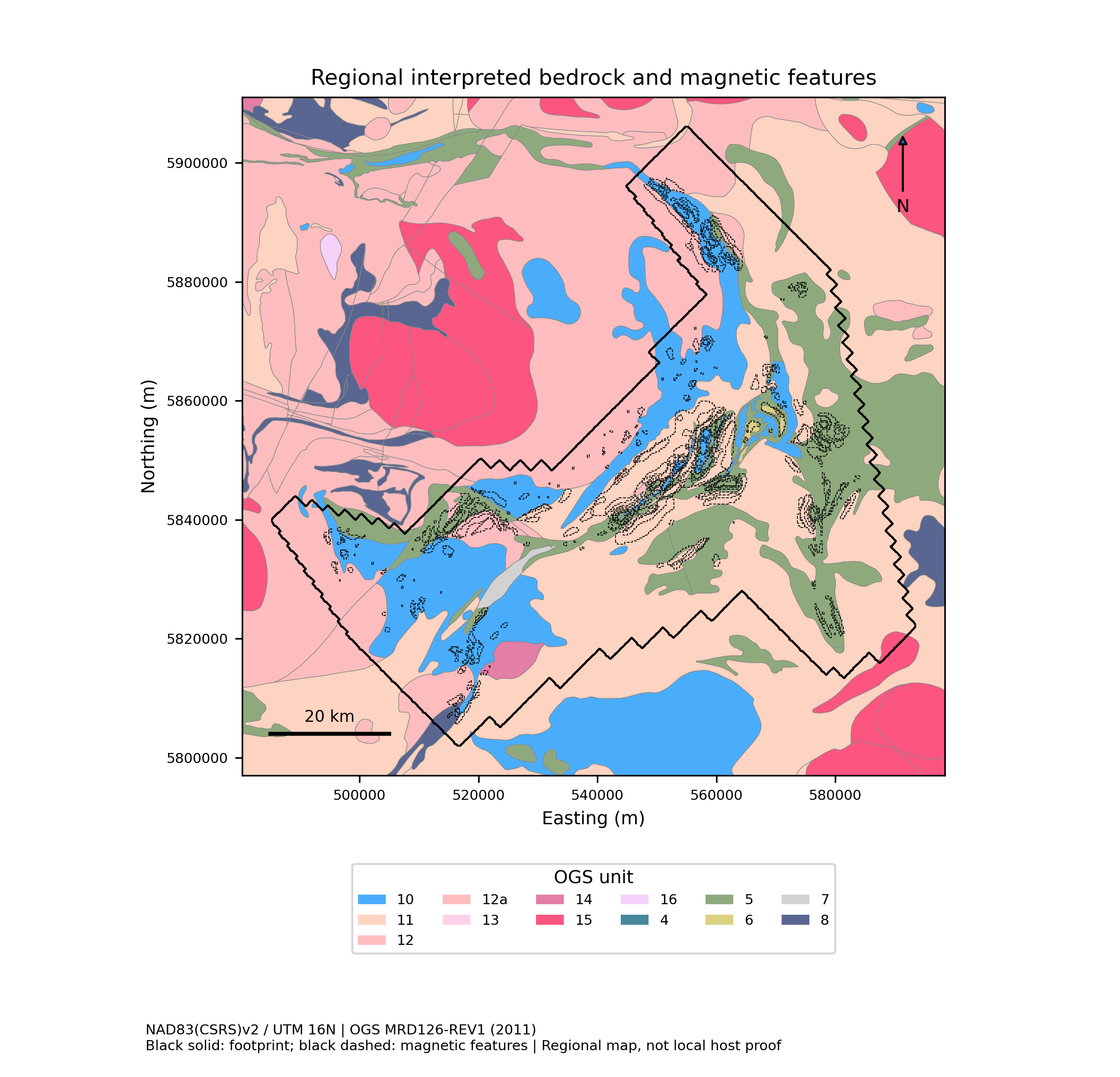
Figure 22. Geological and structural context. Source: Ring of Fire interpretation report, reviewer revision, 28 September 2026. Preliminary interpretation.
EVIDENCE 02
Geology, gravity and terrain
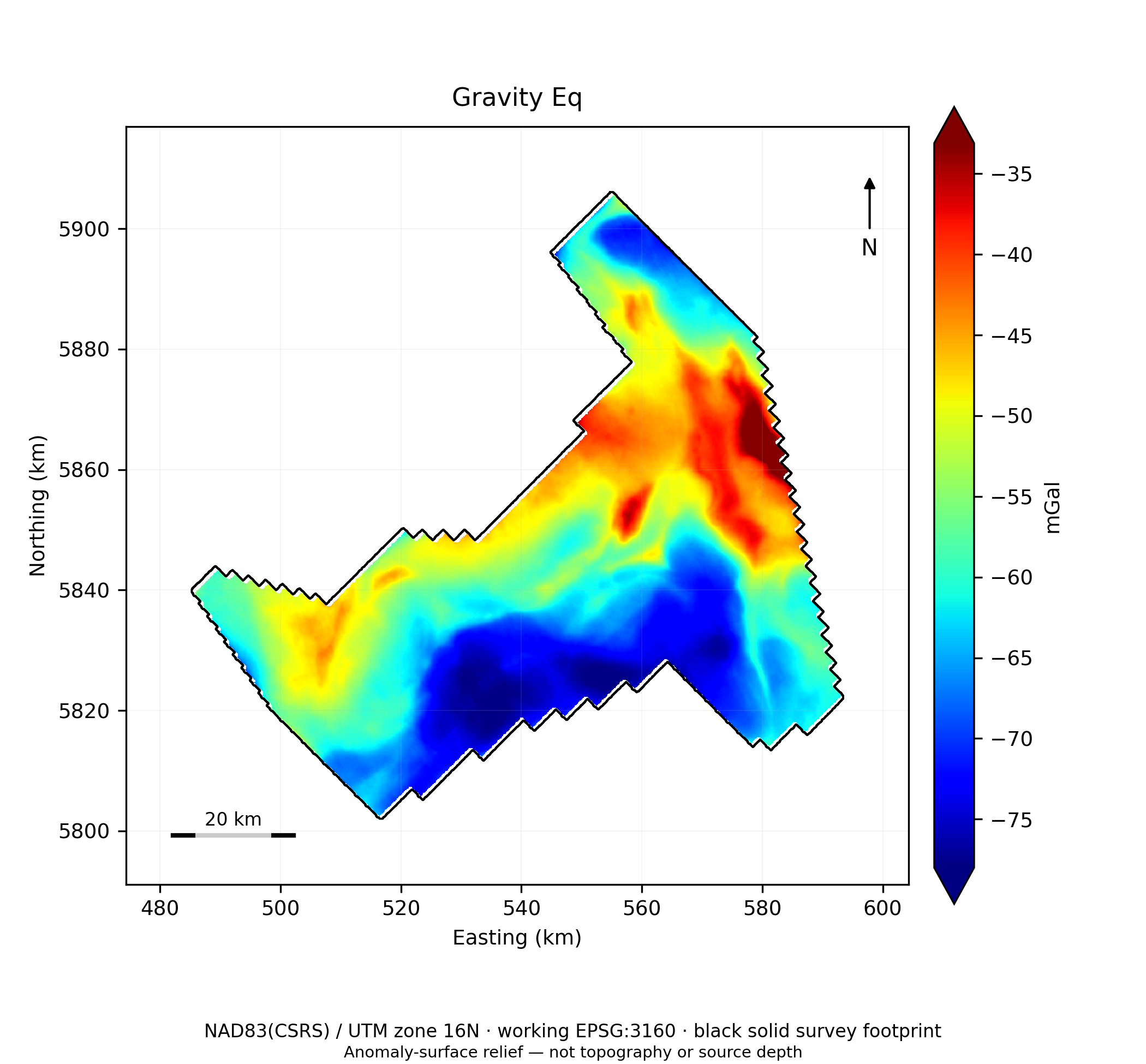
Mapped lithology and structure frame plausible mineral systems. Gravity adds a density-sensitive line of evidence at its actual resolution. Terrain provides context for coverage and access; a DEM is not direct evidence of chromite.
EVIDENCE 03
Drilling and occurrences
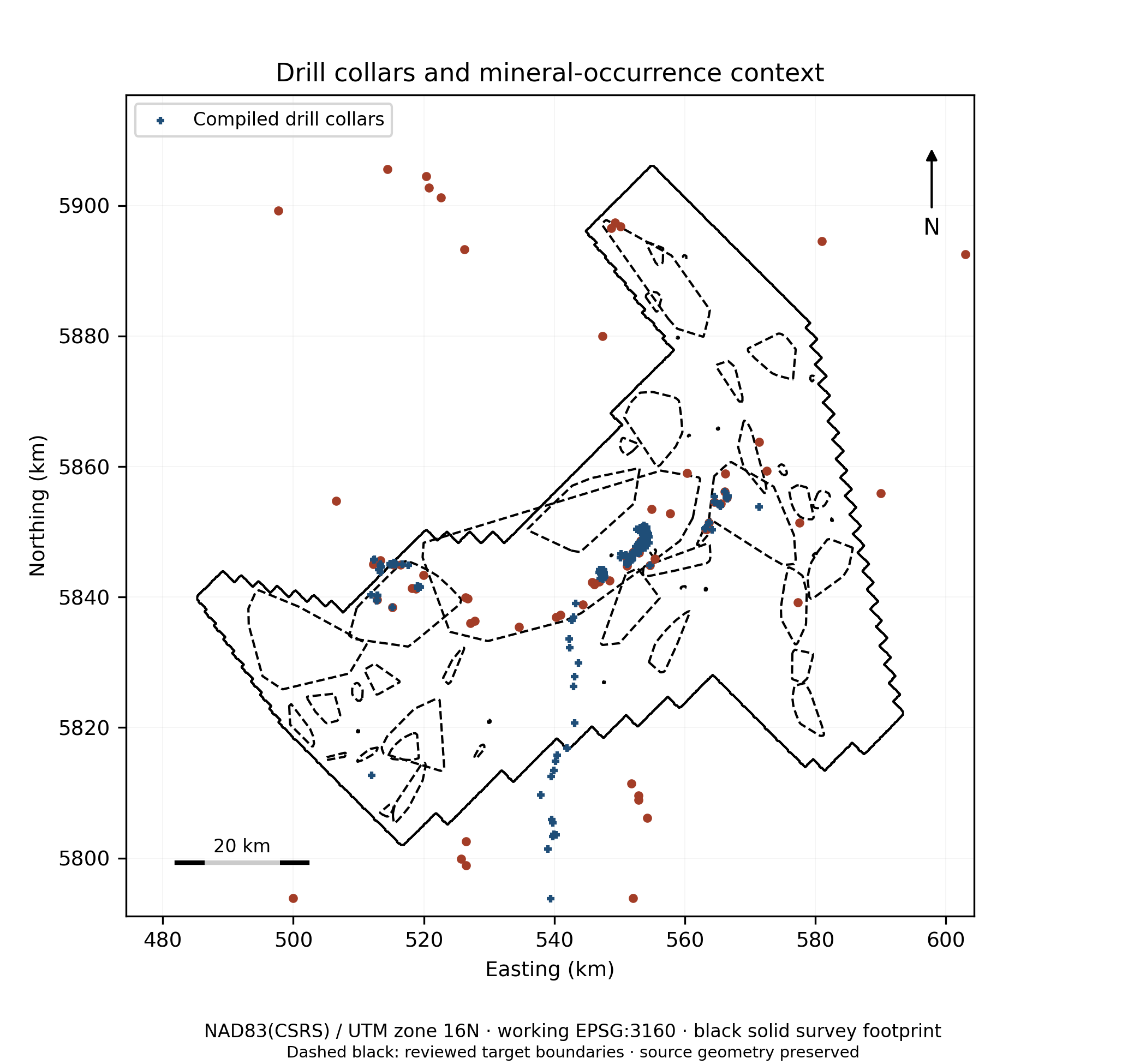
Collars, logs, assays and known occurrences can calibrate or challenge a hypothesis. A nearby point on a map is context; it does not prove that a target was tested or that the same mineralization extends into it.
Figure 24. Drilling and mineral-occurrence context. Source: Ring of Fire interpretation report, reviewer revision, 28 September 2026. Preliminary interpretation.
Figure 25. Gravity and gravity-gradient products — Vertical gravity EQS. Source: Ring of Fire interpretation report, reviewer revision, 28 September 2026. Preliminary interpretation.
EVIDENCE 04
Competing explanations
Intrusions, dikes, remanence and other lithologies can resemble a desired target response. The interpretation records alternatives and proposes measurements that would separate them.
What the team can use
Cross-check independent evidence families
Keep provenance and resolution visible
Explain what could change the ranking
Discuss the evidence with us
The figures above are preliminary public-data examples, not mineral-resource estimates or drilling instructions.