A traceable path from input data to target rationale
The platform is designed around five connected steps: ingest, process, correlate, rank and deliver. Each step leaves a record that a technical reviewer can examine.
Bring together magnetic surveys, GIS layers, geology, gravity, drill information, mineral occurrences and relevant reports. Confirm coverage, units, coordinate systems, lineage and usable resolution before comparing layers.
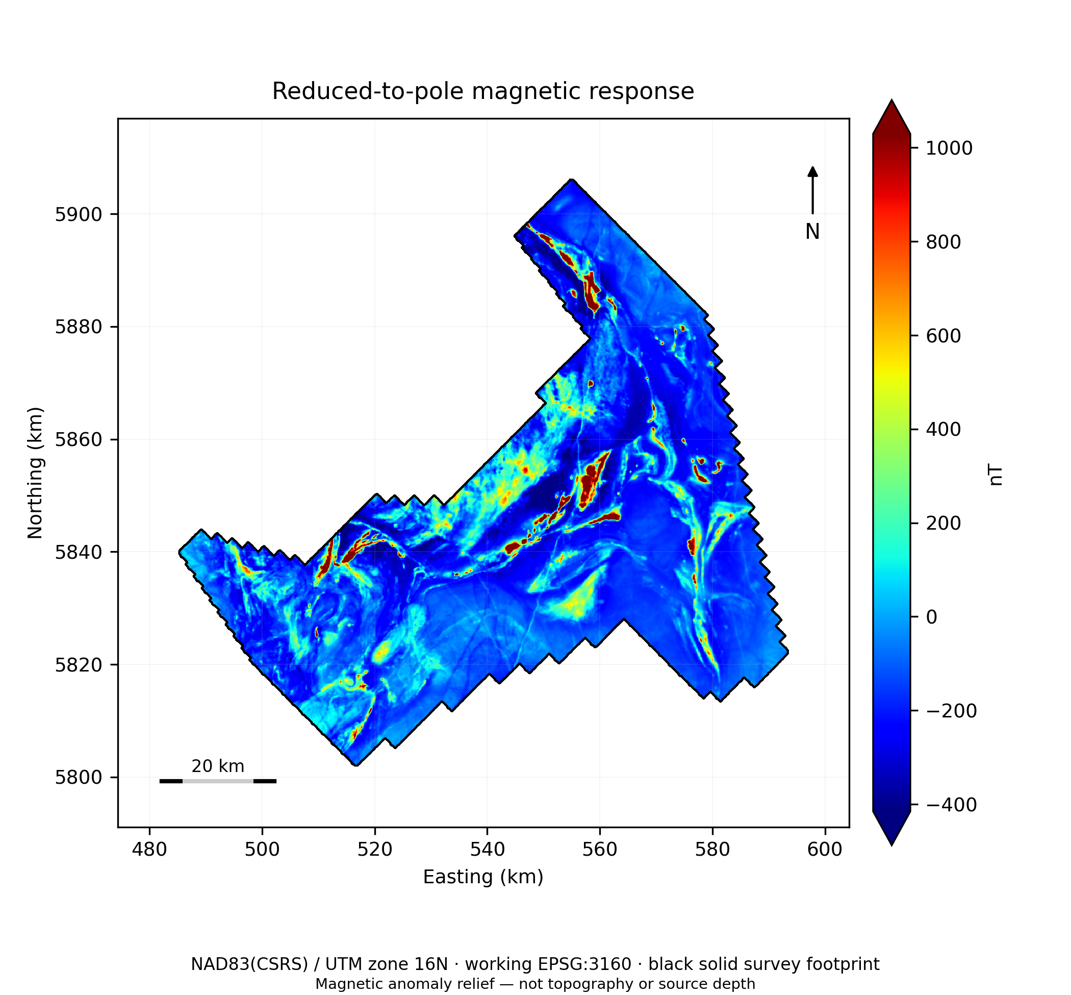
Figure 4. Reduced-to-pole magnetic response. Source: Ring of Fire interpretation report, reviewer revision, 28 September 2026. Preliminary interpretation.
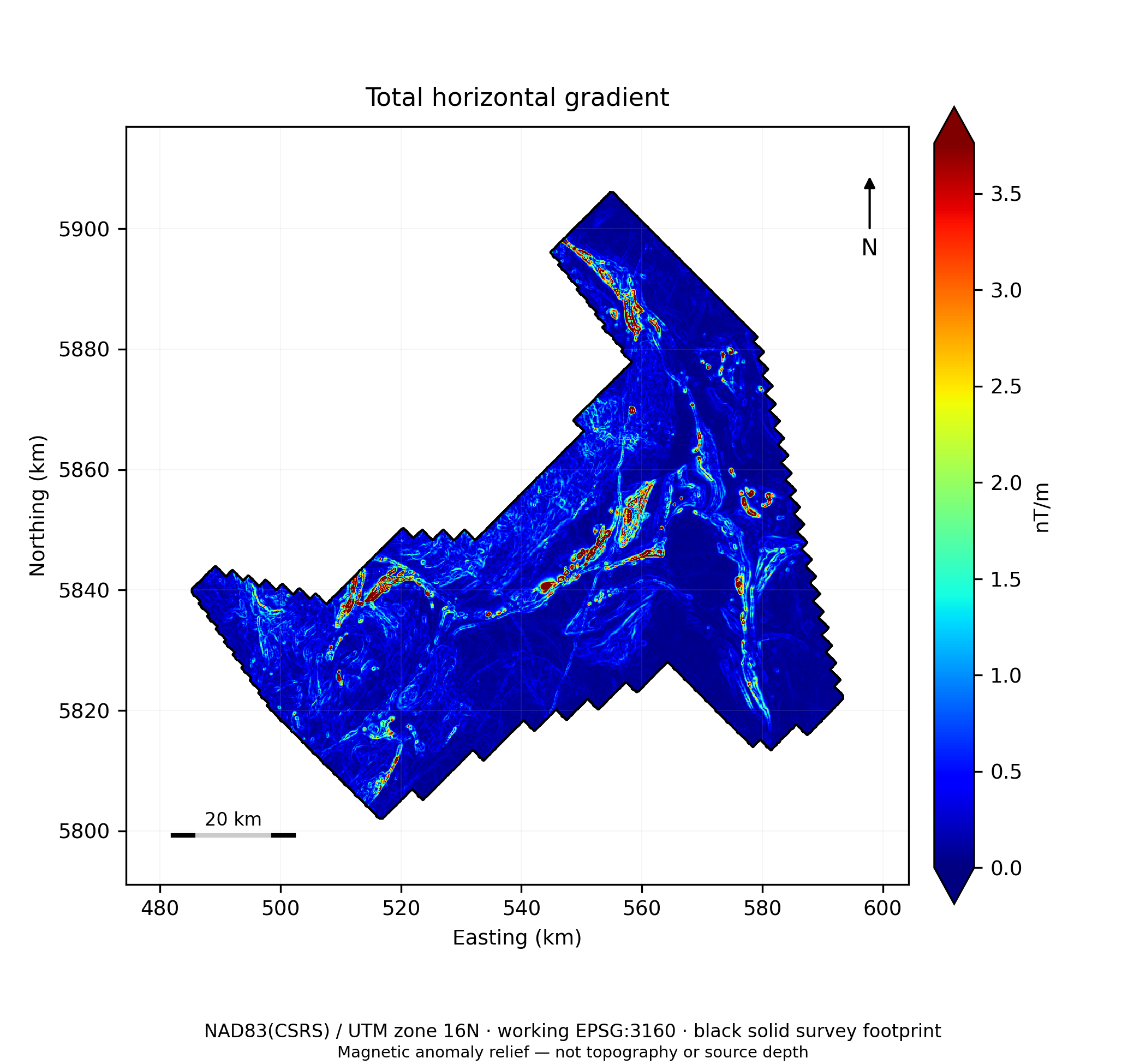
Figure 7. Total horizontal gradient. Source: Ring of Fire interpretation report, reviewer revision, 28 September 2026. Preliminary interpretation.
EVIDENCE 02
2. Process and interpret
Generate appropriate magnetic grids and derivatives, characterize domains, contacts and structures, and flag weak data coverage or edge effects. The methods and scales should fit the survey rather than a fixed candidate count.
EVIDENCE 03
3. Correlate and rank
Test whether independent evidence families support the same geological model. Multiple derivatives of one magnetic grid improve stability checks, but do not count as independent confirmation. Record alternative explanations and evidence gaps.
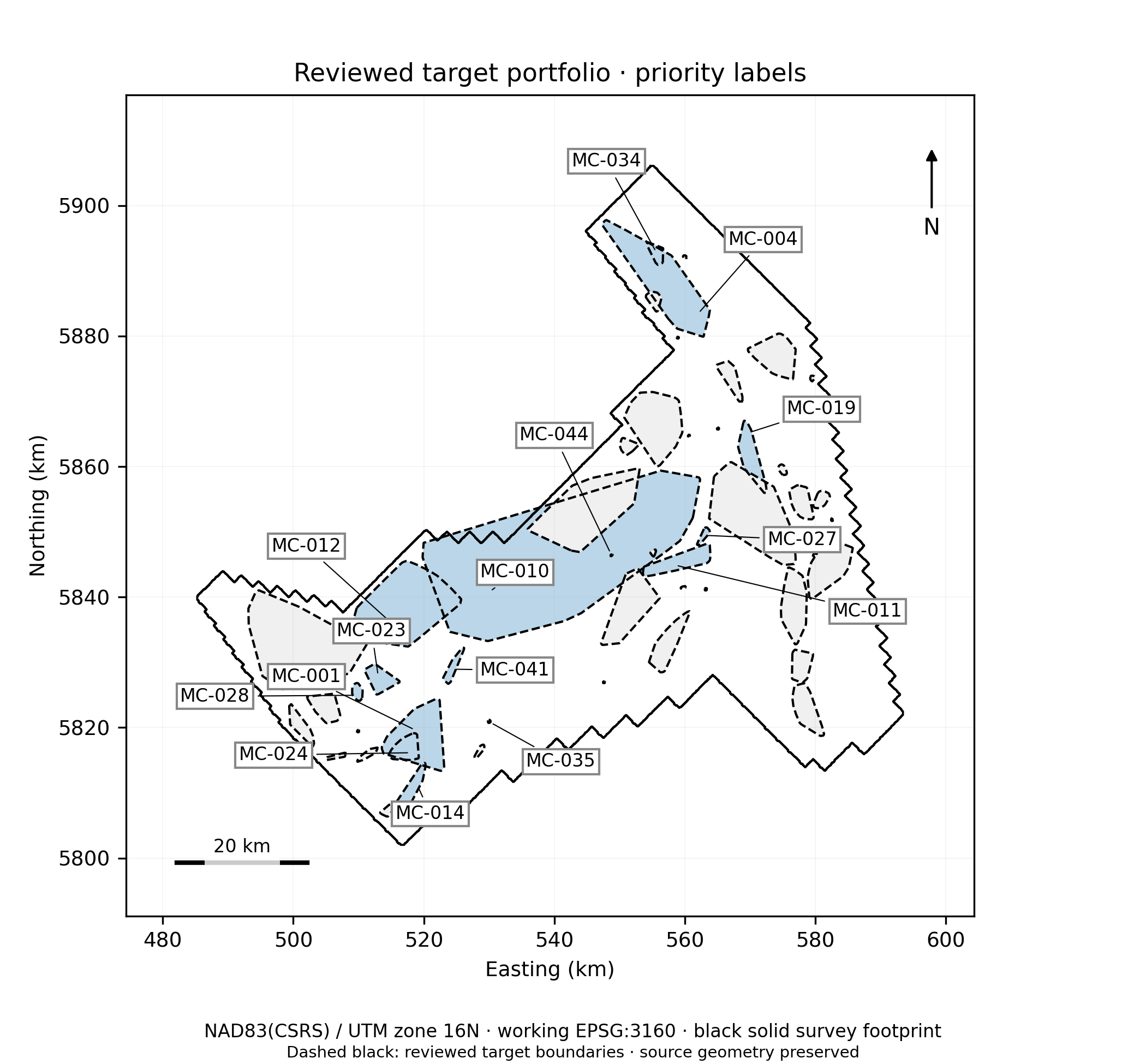
Figure 30. Reviewed priority portfolio. Source: Ring of Fire interpretation report, reviewer revision, 28 September 2026. Preliminary interpretation.
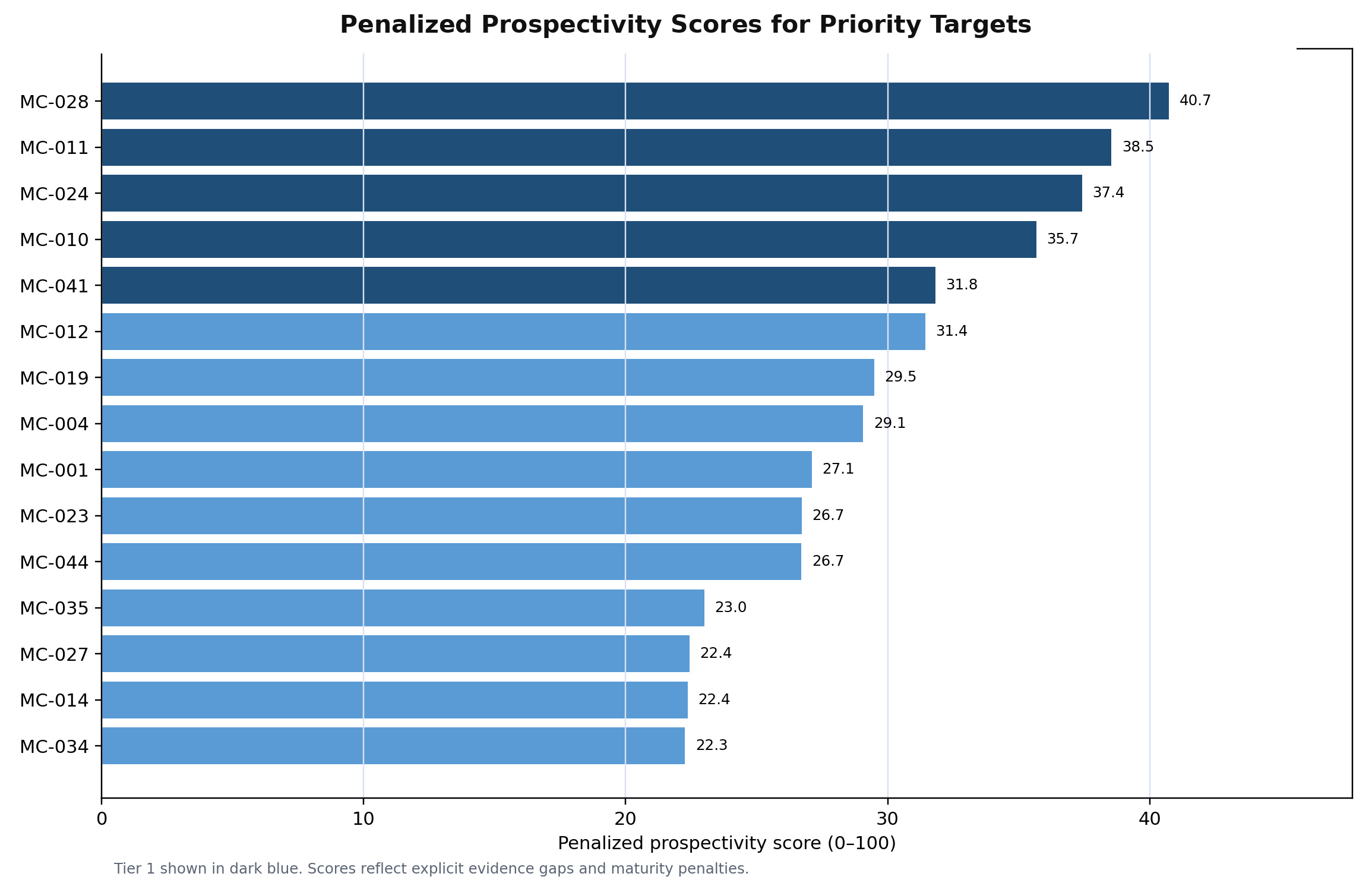
Figure 34. Priority target scores. Source: Ring of Fire interpretation report, reviewer revision, 28 September 2026. Preliminary interpretation.
EVIDENCE 04
4. Review and deliver
Geophysicists examine the maps, target register, caveats and recommended next tests. The output can include an interpretation report, mapped layers and a prioritized work plan, according to the agreed project scope.
What the team can use
Auditable inputs and processing decisions
Evidence-led target prioritization
Clear limitations and next tests
Discuss the evidence with us
The figures above are preliminary public-data examples, not mineral-resource estimates or drilling instructions.