The narrative connects the exploration objective, datasets, processing choices, observations, target rationale, competing explanations and recommended follow-up work.
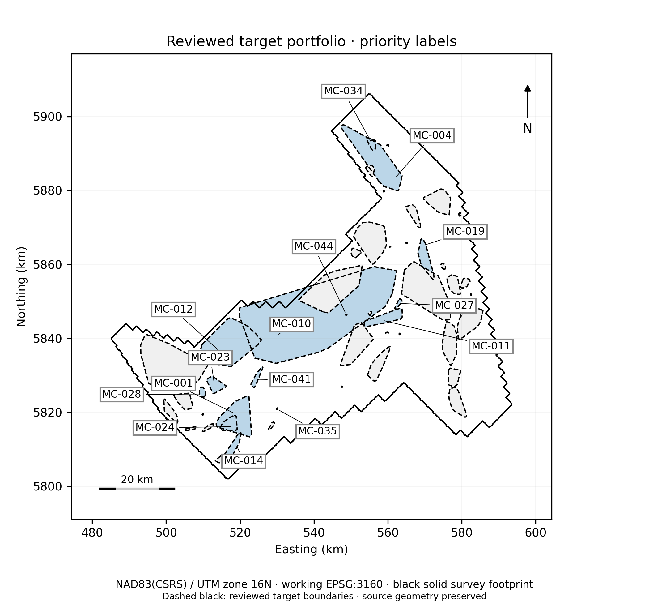
Figure 30. Reviewed priority portfolio. Source: Ring of Fire interpretation report, reviewer revision, 28 September 2026. Preliminary interpretation.
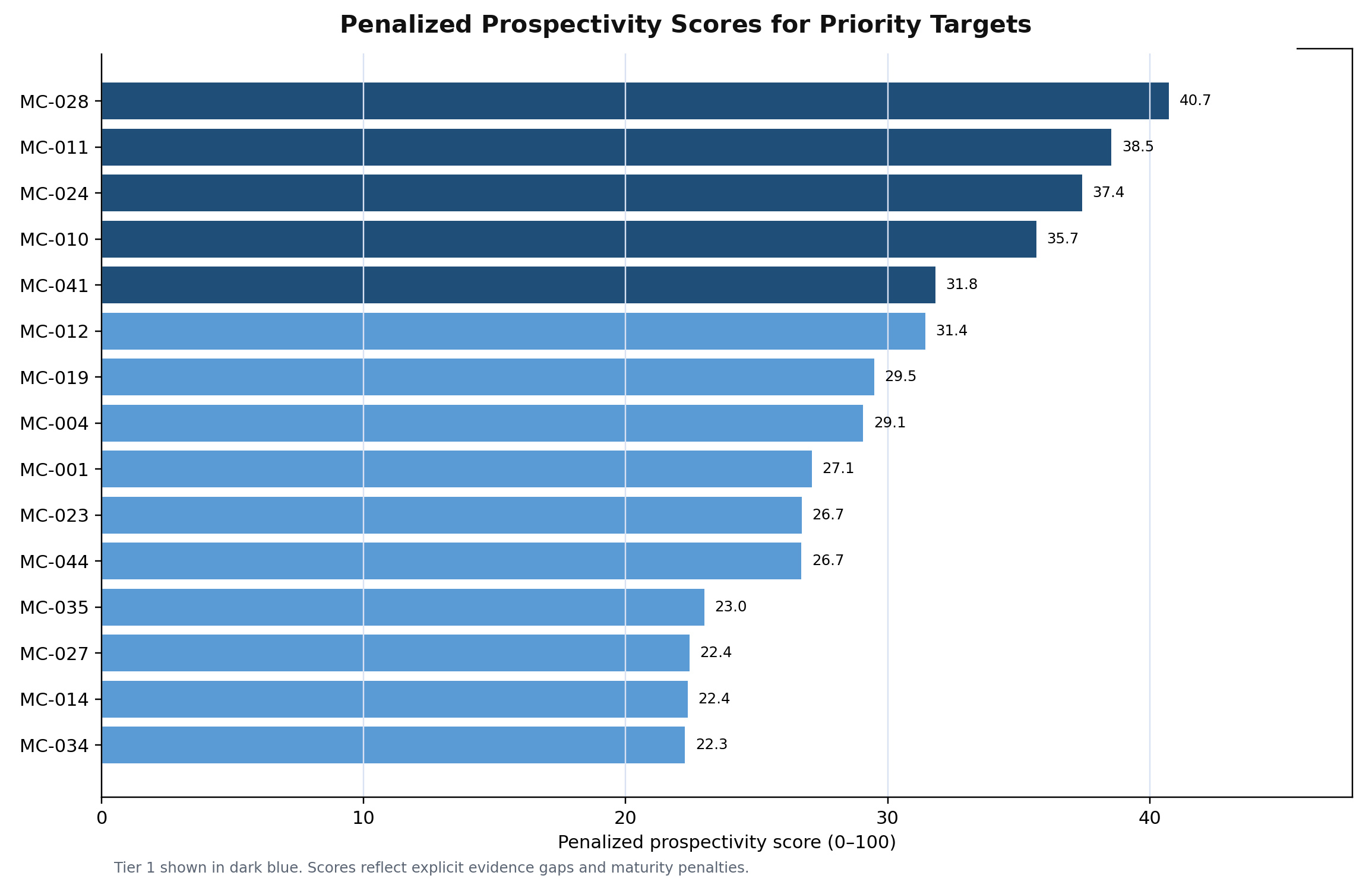
Figure 34. Priority target scores. Source: Ring of Fire interpretation report, reviewer revision, 28 September 2026. Preliminary interpretation.
EVIDENCE 02
Maps and registers
Depending on scope, the package can include georeferenced maps and GIS layers, an anomaly or target register, and concise target cards. These preserve geometry and data provenance for technical handoff.
EVIDENCE 03
Quality and professional review
Coverage, coordinate systems, processing lineage, display scales and evidence gaps are checked. Expert review addresses geological plausibility and uncertainty. Formal 3D modelling is identified only when valid observations, assumptions and diagnostics support it.
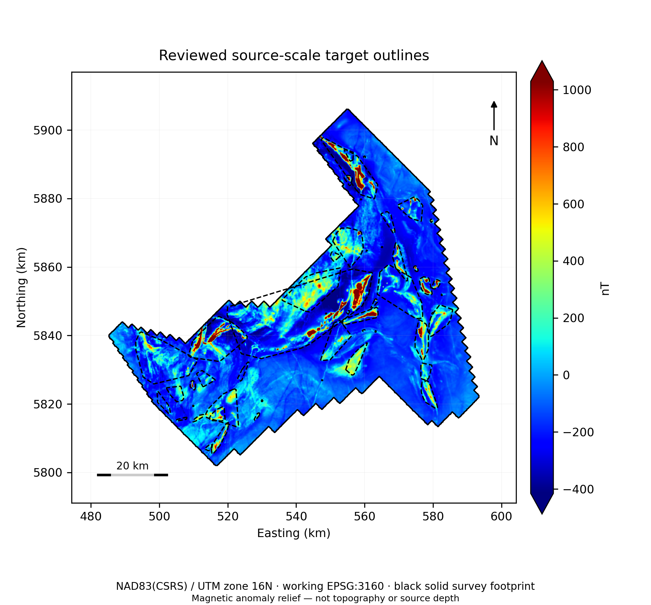
Figure 21. Reviewed source-scale target outlines. Source: Ring of Fire interpretation report, reviewer revision, 28 September 2026. Preliminary interpretation.
What the team can use
Decision-ready narrative with technical traceability
Reusable spatial and tabular outputs
Cautions and next tests alongside each priority
Discuss the evidence with us
The figures above are preliminary public-data examples, not mineral-resource estimates or drilling instructions.