ACIS Consulting and Rosor Exploration combine AI-assisted analysis with geophysicist review to turn survey data and geological context into clearer exploration decisions.
Exploration teams often hold valuable data in separate surveys, maps, drill files and reports. Our workflow brings the evidence together, documents how it was processed and shows why an exploration hypothesis moves up or down the review queue.
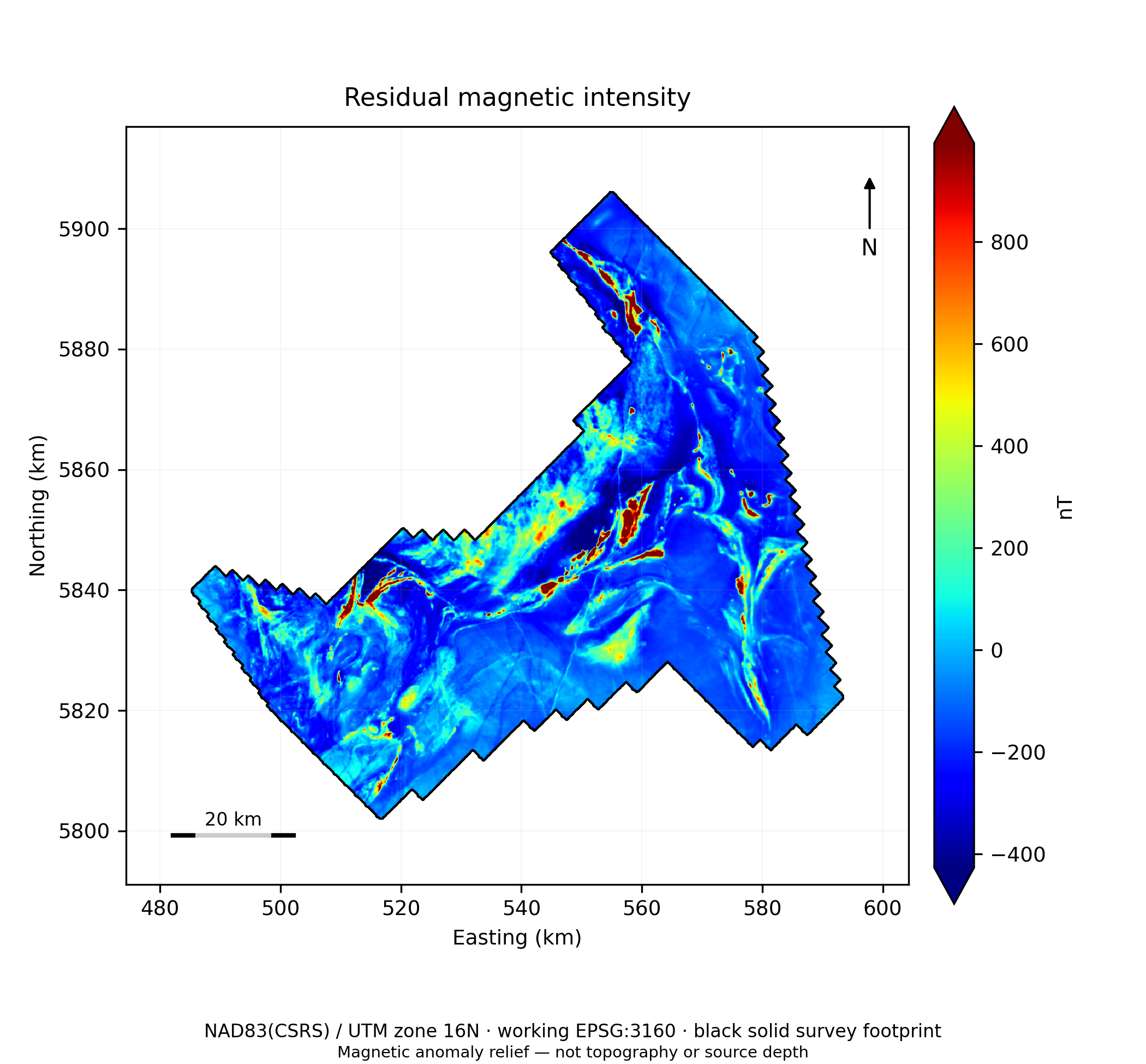
Figure 1. Residual magnetic intensity and survey footprint. Source: Ring of Fire interpretation report, reviewer revision, 28 September 2026. Preliminary interpretation.
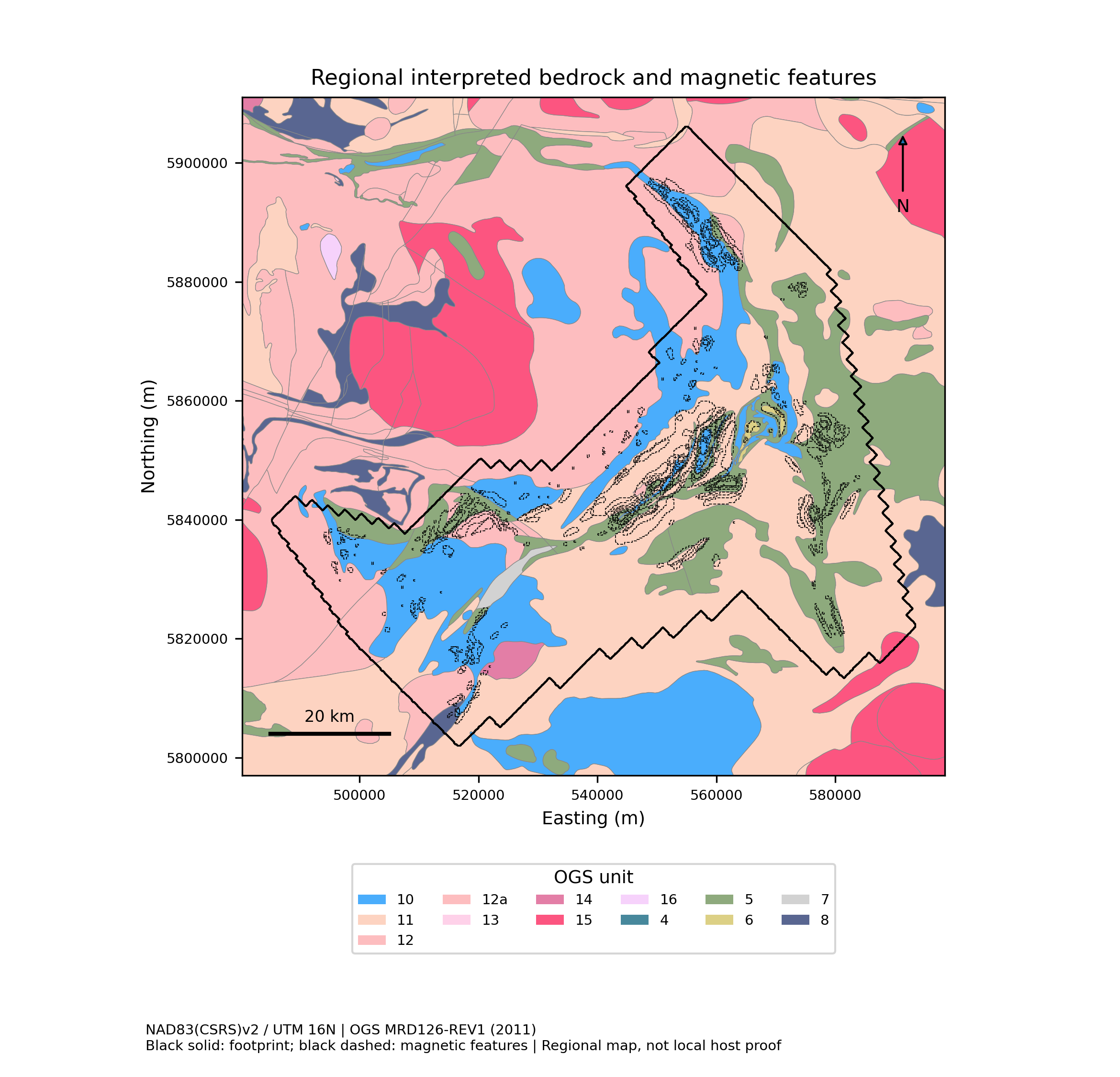
Figure 22. Geological and structural context. Source: Ring of Fire interpretation report, reviewer revision, 28 September 2026. Preliminary interpretation.
EVIDENCE 02
Built for different starting points
Commissioning a magnetic survey? Use the results as a foundation for integrated interpretation. Already have historical magnetic data? Revisit it alongside newer geology, gravity, drilling and mineral occurrence information.
EVIDENCE 03
Expert judgement stays central
AI helps screen patterns, compare evidence and organize competing explanations. Experienced geophysicists review the output and define the next test. A high-ranked anomaly is a reason to investigate, not proof of mineralization.
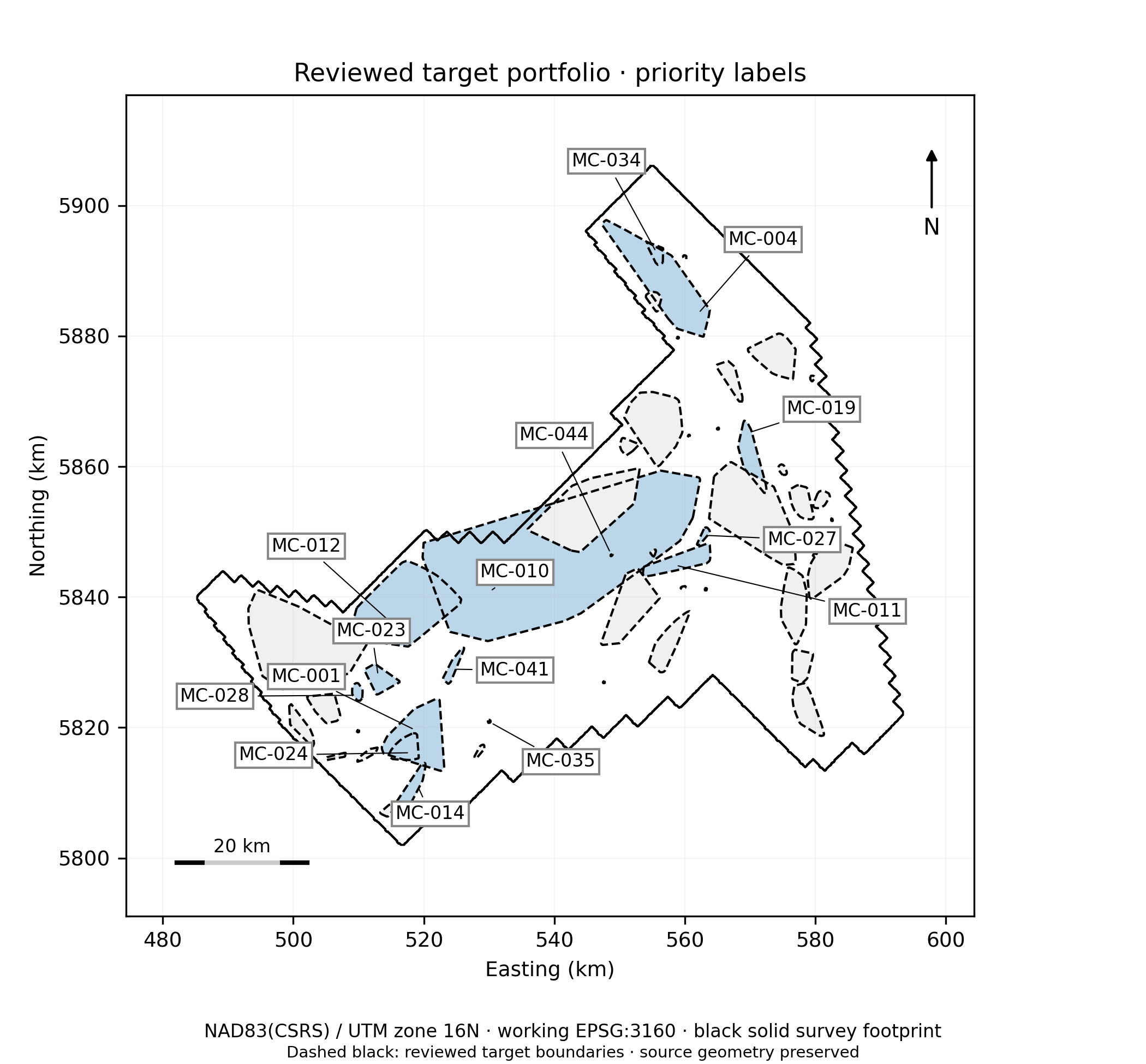
Figure 30. Reviewed priority portfolio. Source: Ring of Fire interpretation report, reviewer revision, 28 September 2026. Preliminary interpretation.
What the team can use
Review more of the available evidence consistently
See the rationale and uncertainty behind each target
Give technical teams a practical path to the next decision
Discuss the evidence with us
The figures above are preliminary public-data examples, not mineral-resource estimates or drilling instructions.